ResourcesNgā rauemi
You can refine your selection by choosing from the topic and languages lists below.
81 results for School
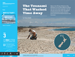
Watch this slide presentation that focuses on researching a historic tsunami in Henderson Bay in Northland.

Visit this virtual field trip from Learnz. In this field trip, experts will take you to remote locations to help you better understand what causes natural disasters.

Use these factsheets from Science Kids about different aspects of storms.

Watch this video on earthquakes produced by National Geographic.

See real time satellite imagery and thunderstorm warnings from MetService to track the storm activity in your local area.

Visit this virtual field trip from Learnz. In this field trip you will learn from experts what caused the Canterbury Earthquakes.

Use this resource designed to help students understand earthquakes in New Zelanad. It includes why we get them and how we measure them.

Learn about shoaling and how it works.
Use data on historical earthquakes to identify when and where they happened. Make predictions about future earthquakes.
Watch this video on tsunami produced by National Geographic.

Find information about Auckland's volcanoes from Auckland Museum.
Visit this useful site with animations showing the movement of tsunami waves.

Watch this video from GNS Science explaining how tsunami are formed and the damage they can cause.
Use Sketchfab to create interactive 3D maps, which you can use to model emergency events.
Read a New Zealand perspective on tsunami on Te Ara, the Encyclopedia of New Zealand.
See New Zealand's volcano cameras and the current volcanic unrest in New Zealand.
Visit this virtual field trip from Learnz. In this field trip, you will see how people live, work and play on the slopes of Mt Ruapehu, coping with the risk of volcanic activity.